
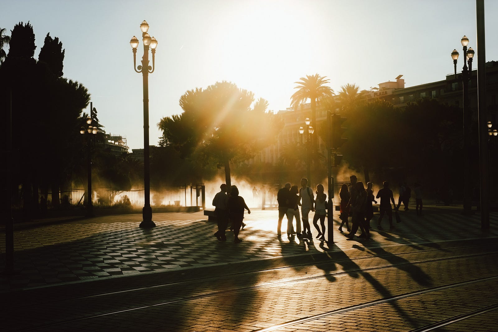
Sustainable Transportation Revolution: The Fused Grid
Sustainable Transportation Revolution: The Fused Grid

Reducing urban carbon emissions by 5% before 2021.
A transportation revolution won’t happen overnight, but it could still happen faster (and cheaper) than you think. Autonomous electric rickshaws, cars, scooters, tricycles, bicycles, unicycles, and skateboards can make our cities more livable and more sustainable. These modes will be even more effective in revolutionizing transportation if they are used to encourage the use of the built-in mode of transportation humans are born with, legs. Mechanized modes of transportation are the perfect compliment or “last mile” solution for cities that prioritize active modes of transportation. The Transportation Revolution we’re waiting for is in Active Transportation, with an assist from small-scale Autonomous Vehicles (AVs). AVs of various sizes are revolutionary only if they’re used strategically in conjunction with human modes of transportation because they’ll fix the Scale Problem in our cities. If all we get out of this technology are self-driving cars, we’ll be no better off than we are today.
The Right Way to Use Autonomous Vehicles
AVs will move us away from private ownership of mechanized transportation and towards an on-demand future. This is a tremendous opportunity to tether vehicle size to intended use and location. The size and speed of vehicles, autonomous or otherwise should be related to the space available where they are used. In other words, the density of a neighborhood directly influences the optimum size and speed of travel on its streets. The Fused Grid is the most efficient way to match the sliding physical scale of our vehicles to the sliding physical scale of the neighborhoods where they operate. Many shapes and sizes of autonomous vehicles will suit the various purposes of the people who use them. A single occupant vehicle will take up the space of a bicycle, a road-tripping AV will take up the space of a minivan. Not only should AVs come in many shapes and sizes, they will be optimized for different speeds. Slower, lighter, and smaller AVs in urban cores, something closer in size and scale to today’s automobiles on rural highways.
The Stakes
At the recent Global Climate Action Summit, Google released data collected through it’s surveillance of private citizens in the hopes of reducing urban carbon emissions and leading to more sustainable transportation planning. The stats are enlightening; maybe letting Google spy on us has some value… Some key takeaways from Google’s data, which has only been released for 5 cities, is as follows (
- If Pittsburghers took an extra 1 million trips a year by bike instead of by car, they would prevent almost 700,000 tons of carbon dioxide from spewing into the atmosphere.
- Vehicle traffic in Buenos Aires releases an estimated total of 5,860,000 tonnes of carbon dioxide per year, over 4 times the amount attributed to transportation in Pittsburgh.
Some Important Stats from other sources:
- Research has found that if, globally, cycling rates can rise from their current level of 6% (around 1% in the U.S.) to around 14%, urban carbon emissions will drop 11%. (Fast Company)
- In a scenario where 14 percent of travel in the world’s cities is by bike or e-bike in 2050, carbon emissions from urban transportation would be 11 percent lower than a scenario where efforts to promote sustainable transportation sidestep bicycling. (Streets Blog, Quoting ITDP)
The Problem: There’s No Room
The Scale Problem in Cities and the Time-Space Continuum
Time and space are linked. We use one to define the other. A meter is defined by how far light travels in a very small fraction of a second. A second of time is defined by the rate of decay of a certain type of matter, space. If you speed up, you’re effectively making distances shorter. When we invented planes and global communications, we effectively made our lives longer because hours replaced weeks for travel and communication.
Walking in Manhattan is effectively faster than walking in farmers fields, even if the velocity is the same. How can this be possible? When we build cities up, we bring various land-uses closer to people. In a rural setting it might be miles between the home and grocery store. In the city, hair cuts, grocery shopping, work, and doctors can all be on the same block. So even though walking happens at the same globally defined speed in each place from a physics perspective, the “effective speed” is much higher in the city because you can get much more done.
Scale Relativity
Your optimum speed is relative to your goals. Are you looking to get groceries or cross the country? In the former case and in Manhattan, there’s a very strong case that walking is faster than driving, even though cars travel at faster speeds. Congestion and parking more than eliminate any speed advantage that cars might have. When crossing the country, it’s clearly more appropriate to choose to drive instead of walking. It’s a matter of scale: Scale of uses, distances, and goals.
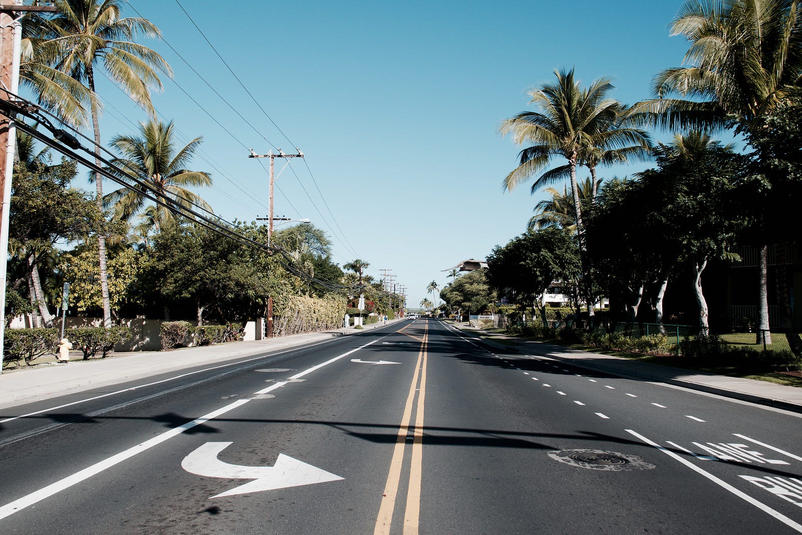
The footprint of everything shrinks as cities get more populated. Uses are stacked and lots are subdivided. Everything, that is, except cars. We drive the same size cars on the interstate between cities as we do in the cores of these cities. We force the round peg through the square hole when we force urban spaces to accommodate today’s cars. Every mode has its place and it’s all a matter of space. The size of vehicles should scale to space available where they will be used. Small space? Small vehicle. Vehicles should also scale to a speed that corresponds to the concentration of uses. Here are examples of 3 types of vehicle scales that link the size of the vehicle to an important urban metric (speeds in metric, because it better emphasizes scale):
Scale of Distances:
- Plane Scale: If the trip is longer 500 km (200,000 m), take a plane, which travel at speeds over 700 km/h. This is a maximum 1.4:1 speed to distance ratio.
- Car Scale: If the trip is longer than 10 km (20,000m), take a car, which travels at speeds over 100 km/h. This is a maximum 10:1 speed to distance ratio.
- Bike Scale: If the trip is longer than 2 km, take a bike, which travels at speeds around 25 km/h. This is a minimum maximum 12:1 speed to distance ratio.
- Human Scale: If the trip is measure in increments of 0.1 km (100 m), take your legs and walk at 7 km/h. This is a maximum 14:1 speed to distance ratio for half km or 500 m walk.
- Obviously, there is some overlap between modes and distances, but this illustrates optimums.
Scale of Land:
- Car Scale: If the lots are bigger than 10 acre, take a car, which travels at speeds around 100 km/h. This is a 10:1 speed to land area ratio. Cars take up about 6.75 square meters, the lot-size to vehicle size ratio is about 6000:1.
- Car Scale (again): If the lots are bigger than 2 acres, take a car, which travels at speeds around 80 km/h. This is a 40:1 speed to land area ratio. Cars take up about 6.75 square meters, the lot-size to vehicle size ratio is about 1200:1.
- Bike Scale: If the lots are bigger than 1 acre, take a bike, which travels at speeds around 25 km/h. This is a 25:1 speed to land area ratio. Bikes take up about 2 comfortable-to-cyclists square meters, the lot-size to vehicle size ratio is about 2000:1.
- Human Scale: If the lots are smaller than 1 acre, take your leg and walk at 7 km/h. This is a 70:1 speed to land area ratio. Bikes take up about 1.5 comfortable-to-humans square meters, the lot-size to vehicle size ratio is about 270:1.
Note: These are illustrative ratios, not scientific ratios.
Scale of Uses:
As cities get denser, lots get smaller and land-uses start to stack on top of one another. The number of uses on a plot of land is connected to the lot size. Setting urban land use as the baseline, the optimum, we can compare other densities of land and various transportation modes. Urban land-use is optimum because it concentrates land uses, you use the land for more activities.
Some quick and dirty numbers:
- Urban Lots: 0.1 acres, 20 m of frontage, 4 uses, pedestrians travel at 7 km/h and can cross up to 350 lot frontages. Therefore, they have access to 1400 activities per hour.
- Suburban Lots: 1 acre, 64 m of frontage, 2 uses, cars travel at an average 30 km/h and can cross up to 500 lot frontages. Therefore, they have access to 1000 activities per hour if we mixed uses in suburban spaces, which we do not. The fact is, it’s only with access to malls or mega-strip-mall complexes that this number can be achieved. In reality, this number is much lower, but this will doe for the illustration.
- Semi-Rural Acreage Lots: 2 acres, 90 m frontage, 1 use, cars travel at 80 km/h and can cross up to 900 lot frontages. Therefore, they have access to 900 activities per hour.
- Rural Lots: 10 acres, 200 m frontage, 1 use, cars travel at 100 km/h and can cross up to 500 lot frontages. Therefore, they have access to 500 activities per hour.
Actually determining access to uses is very complex, these are ballpark numbers that serve as an illustration. The calculations assume that we we mix uses evenly through lots, which is not the case. Consider these calculations like you would a sketch, they are intended to illustrate the concept that urban forms allow access to more activities even at slower speeds. The example also illustrates the type of calculations needed to determine these metrics of scale. These calculations show that urban pedestrians have access to nearly 3 times the activities as the rural car-driver, 1.5 times the activities as the semi-rural car-driver, and 1.5 times the suburban car driver. I bet more scientifically rigorous numbers would generate similar ratios. All this is to say, that we don’t need to travel faster to get more things done. Shrinking distances is more effective than traveling faster.
The Solution: The Fused Grid
Adjusting to prioritize any other transportation mode than the car is considered revolutionary in North America and much of the world. Many people like to think we need to throw money at transportation problems in our cities, that we need to drastically alter our urban spaces to make this happen. The truth is, we don’t need to spend trillions of dollars. We don’t need AI, or 5G Wireless Networks, or the Internet of Things. All we need is the Fused Grid. The fused grid can be thought of as multiple grids of different spacing superimposed upon each other. Each grid corresponding to a different mode of transportation, each mode corresponding to a different scale of distance and density. You have a “Car-Grid” at “Car Scale,” a “Bike-Grid” at “Bike Scale,” and a “Human Grid” at “Human Scale.”

Each grid has a different primary road type and road cross-section. The mode that gets the middle of the street and doesn’t have to cross a bunch of grade changes is the mode that’s being prioritized. Today, car’s take the middle on most of our roads and they’re driving surface doesn’t have a bunch of grade changes like a sidewalk. This is an implicit signal, or nudge, showing which mode is taking priority. It also increases the cost of selecting to travel by another mode. With the implementation of the Fused Grid, cars take the middle of the road on the Car-Grid, bikes take the middle in the Bike-Grid, and humans take the middle in the Human-Grid. There happen to already be examples of these type of streets.
Car-grid roads look like today’s roads. Bike-Grid and Human-Grid streets are much the same, with perhaps some different surface materials. Here are some examples.

Design of these grids is fairly simple.
First, start with the Car-Grid which is designed at car scale for speeds upwards of 80 km/h. Spacing of intersections is based on the minimum distance this mode should be used for, 10 km. This generates a 10 km by 10 km grid. These are roads that look like today’s wide roads in most North American cities. This optimizes for the speeds that makes cars unique.
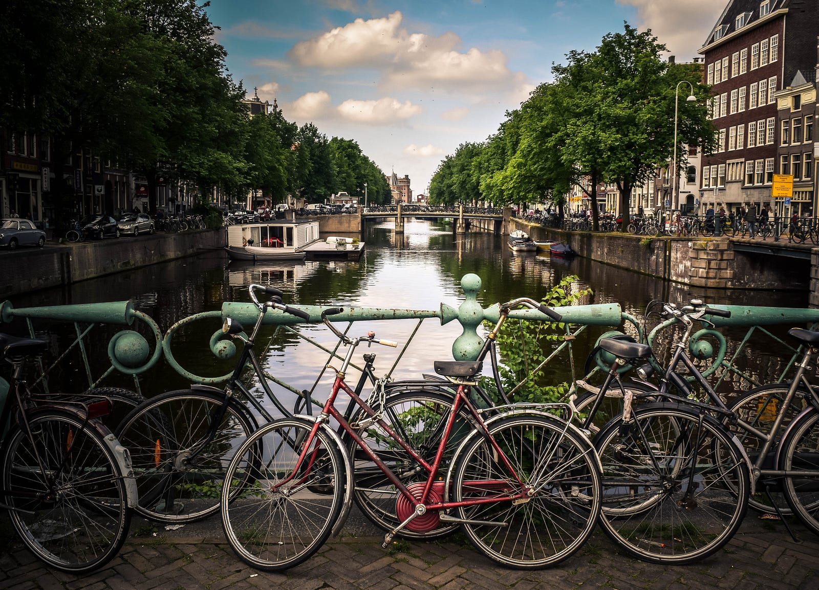
Second, superimpose the Bike-Grid to fill in the gaps as development starts to become more dense. Following the same scale theory as the Car-Grid, the Bike-Grid is 2 km by 2 km because that is the optimum distance for travel by bicycle. These are streets that look like the Fieestrooks in The Netherlands.
Finally, as the town becomes a city, it is time to build at the Human Scale. The Human-Grid has spacing much like today’s urban blocks, which in New York are 200 m by 100 m. These are streets that look like the streets in pre-automobile cities.

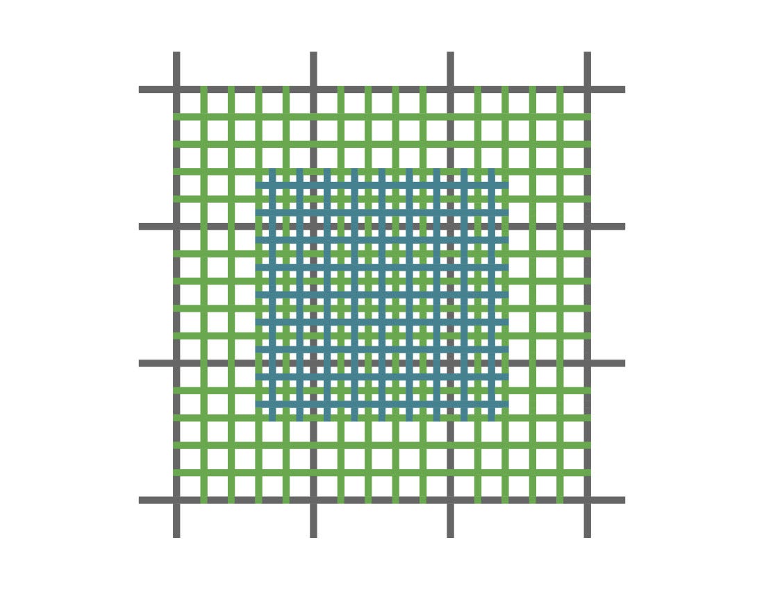
The Bike-Grid and Human-Grid are not perfect for Self-Driving cars, but they are perfect for autonomous vehicles of various sizes. AVs fit perfectly within the Fused Grid. On the car grid, self-driving cars will optimize the free flow and speed. On the bike grid, autonomous vehicles will be scaled down in size and speed to accommodate higher levels of cyclist and pedestrian traffic. They’ll be quieter, slower, lighter, and even softer. On the pedestrian grid, this will be taken even further. Of course, any mode of any scale is allowed on any grid, the prioritization just changes the behavior of the modes slightly on street to another. Car-Grid is optimized for travel faster than 80 km/h, Bike-Grid is optimized for speeds of around 25 km/h, and Human-Grid is a pleasant 10 km/h or less.
It’s simple, where lots are bigger than 2 acres, cars take priority. Where lots are smaller than 2 acres, but larger than .25 acres, bikes take priority. Anywhere with smaller lots, legs are the prioritized mode of transportation. The specific geographic features of different cities generate a variety of fused grid geometries, you can find many examples of configurations with a Google Search of Fused Grids. But the fundamental principles are the same. A more tightly connective and permeable grid is used for slower modes of transportation and the grid for these modes matches the scale of the development around them.
“If you want creativity, cut one zero from your budget. If you want sustainability, cut two zeroes from your budget.”
—Jaime Lerner
Save money; make small plans with big impacts.
A lot of the talk surrounded the coming Transportation Revolution centers on solutions that will cost Trillions of dollars and incur huge cultural changes. This is not the case with the Fused Grid. For one, the Fused Grid returns us to the most natural of transportation modes, walking. Secondly, we already have a Fused Grid, but it’s a fused grid for cars only. We have hierarchy of roads, but they’re only differentiated by speed limit. There are freeways, arterials, collectors, and local roads all with different speed limits. The change to a multi-modal Fused Grid requires only changing the speeds a little and painting new lines to give the center to different modes. It’s a very cost effective solution with minimal cultural change. Local roads become shared streets, collectors become bike friendly fiestrooks, and arterials get fewer traffic lights and move cars more efficiently. Simple and straightforward. Best of all, it costs next to nothing. Compared to “Smart” cities, these costs would be considered a rounding error.
Another way of looking at it is like the Fused Grid filters modes as you get closer to the core. A person could take a self-driving car from the edge of one city to another over a few hours then have a cheaper self-driving rickshaw waiting for them as the grid tightens up, then hop on a bikeshare or just take the rickshaw the rest of the way. If this person wants to take the self-driving car the hole way, the cost to take this mode is low. If they want to keep the weight off and walk a few miles, it’s cheap to choose this option; they don’t even have to sacrifice safety or comfort like pedestrians do today. The car trip could also take place on different forms of mass transit, some more luxurious than others. In these scenarios, small scale autonomous vehicles, not cars, are used for the “last mile” of the mass transit trips and the use of these smaller scales makes choosing a natural, active mode less costly than it is today. The cost of taking active modes today come in the forms of lost safety, increased stress, inefficient routes, terrible aesthetics, and a whole lot more. We can solve these problems with the Fused Grid.
The Time is Now, and The Place is Here
If your city doesn’t cut emissions from transportation by 5% within two years, it doesn’t care about sustainability. For a long time, low-cost solutions have been available. No more excuses. Time to get to work. Unsustainable urban transportation isn’t an expensive problem to fix. Anyone who thinks we need expensive “Smart” technology, Artificial Intelligence, 5G connectivity, elaborate tax schemes, or any other hyper-expensive tech to save us is just being lazy. Give humans space to roam, that’s all we have to do to cut our emissions drastically and start making cities great again.
“There is no magic in simply removing cars from downtown, and certainly none in stressing peace, quiet, and dead space. The removal of the cars is important only because of the great opportunities it opens to make the streets work harder and to keep downtown (read: urban) activities compact and concentrated. ……. The whole point is to make the streets more surprising, more compact, more variegated, and busier than before-not less so.”
— Jane Jacobs