Mapping Traffic Accidents in Metro Manila
Results
At the time of writing, my program successfully processed 15,000+ records from 2015.csv. Google Maps limits free API calls to 2500 a day, so I’ll still need over a month to process the remaining records at my current rate. However, I think there’s enough processed data to make some interesting visualizations.
DISCLAIMER: Please take these results with a grain of salt. I’ll discuss the possible sources for error in the next section. Now, onto the results!
An Overview
Accidents are marked orange-red. Red points mean more accidents happened around that point, while orange spots mean less (but at least one) accidents happened around that point. All visualizations done with Carto.

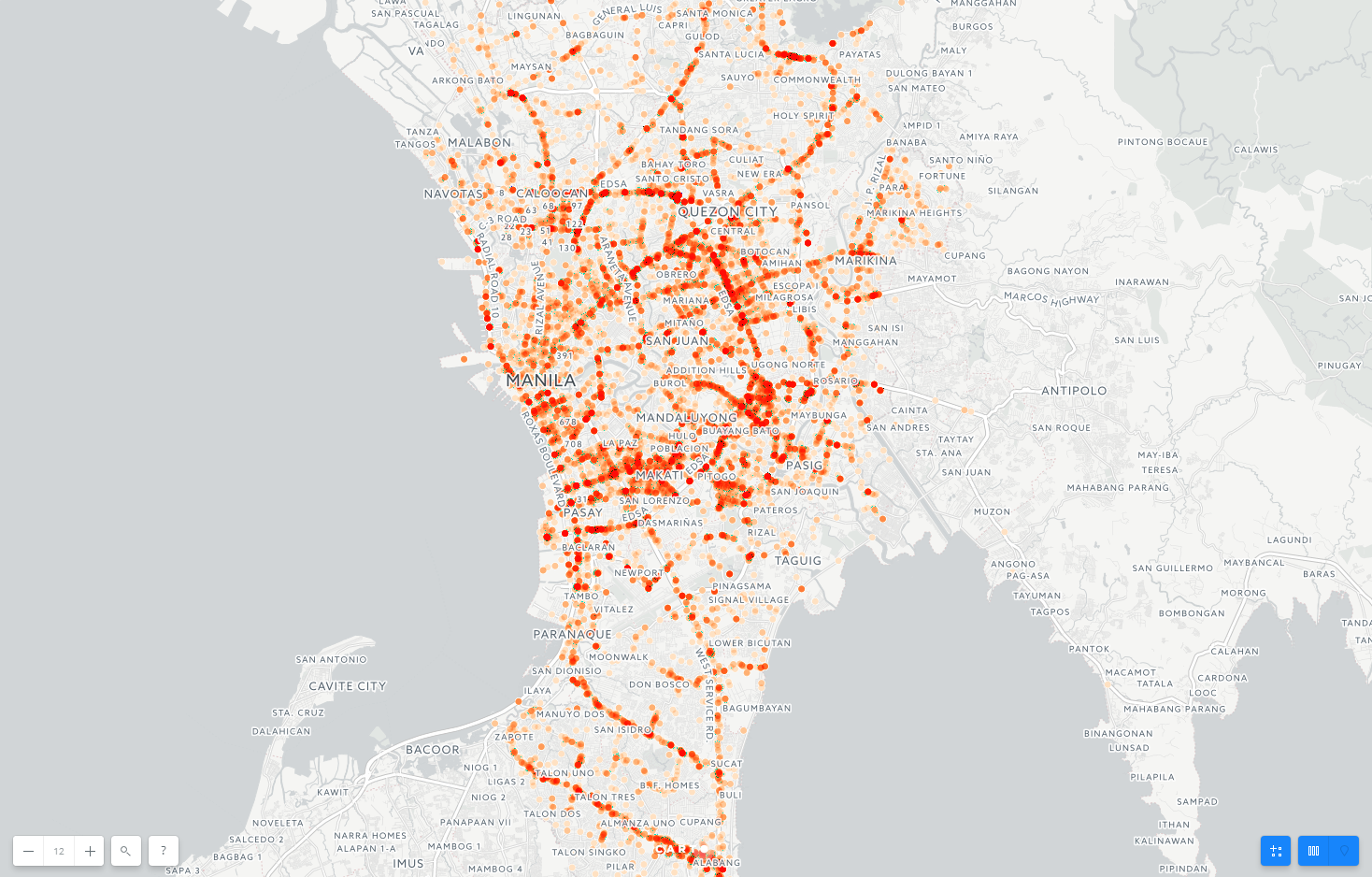
The dataset contained traffic accidents that occurred primarily in the Metro Manila area (at least from the records I processed), and the visualization confirms that; the Metro Manila area is teeming with recorded accidents compared to other surrounding regions, such as Antipolo to the east.
Of the traffic accidents processed so far, most of them seem to take place in northern / middle Metro Manila. Several main highways, such as C-4 and R-7, go through Metro Manila, bringing in hundreds of thousands of vehicles each day. It’s possible to trace the outlines of those highways in the picture above.

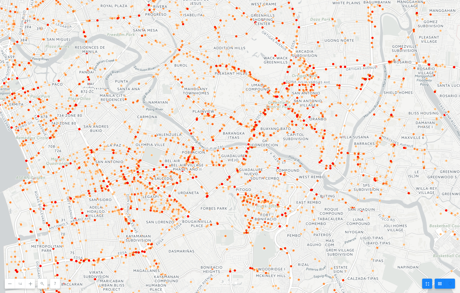
Besides main highways and avenues, traffic accidents also took place in the smaller roads that branch out to the residential and business districts. For example, the financial centers districts Makati and Fort Bonifacio (south of the Pasig River in the picture above) are dotted with traffic accidents.

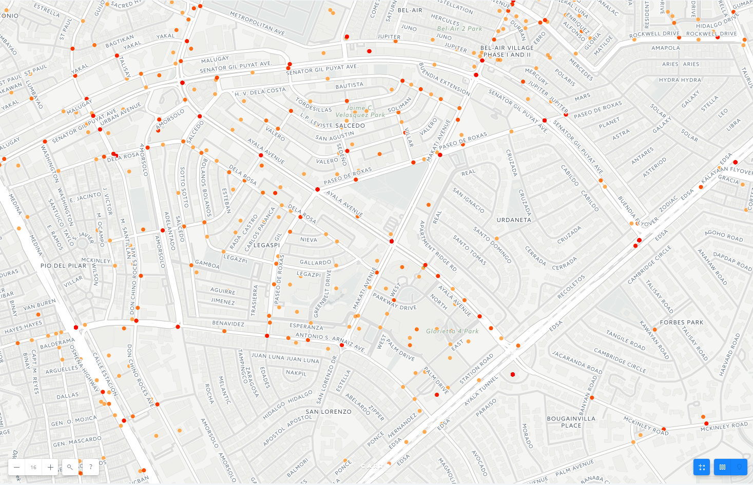
Many roads that permeate the business and residential districts are narrow, crowded, and precarious to navigate through. For example, a closer look at the Ayala Triangle area in Makati (pictured above) reveals many accidents in the smaller roads.

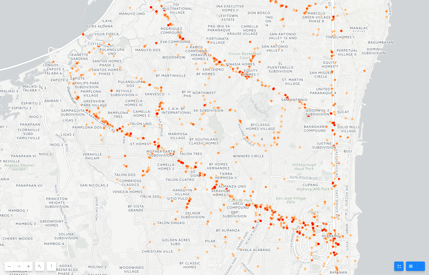
Besides northern Metro Manila, some of the traffic accidents processed took place in southern Metro Manila, such as Alabang, Las Pinas, and Paranaque. It seems that the majority of accidents in the southern area are clustered around the main roads, such as Alabang-Zapote Road and Sucat Road.

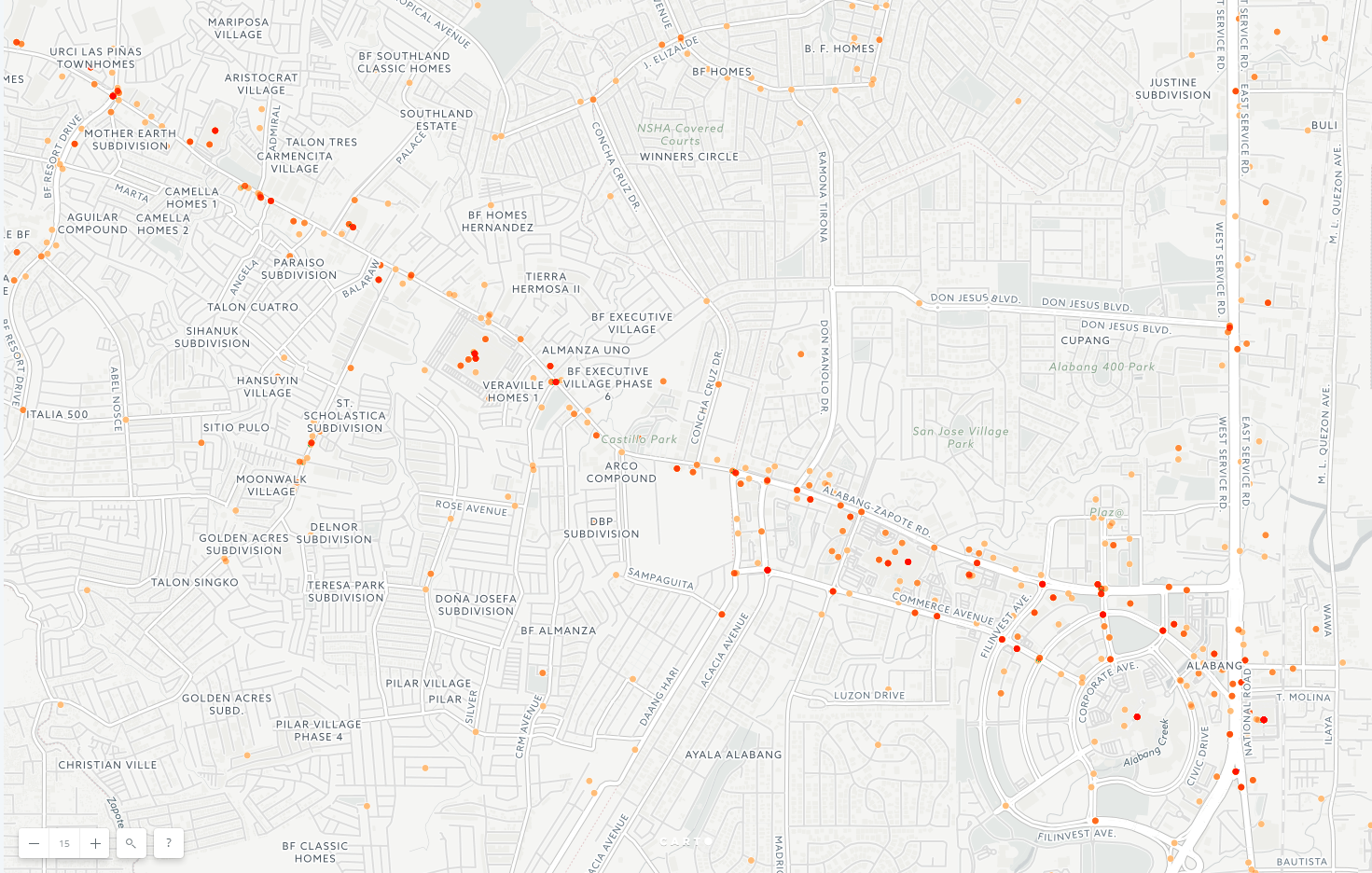
Alabang-Zapote Road is not elevated, so many streets leading into residential subdivisions intersect with Alabang-Zapote Road. From my experience driving through Alabang Zapote, many of the intersections don’t have traffic lights or round-the-clock traffic enforcers, leaving the drivers with the risky responsibility to merge and turn appropriately.
