Where does sand come from?
Sand is, indeed, just a bunch of tiny rocks. It is also one phase of the endlessly churning rock cycle that has been shaping the surface of our earth for the last 4.5 billion years. Far from being overrated, I think having an appreciation for the rocks under our feet makes for a more fulfilling beach going experience.

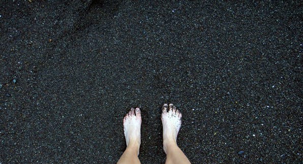
Sources of Sand
I had assumed that sand comes from the erosion of the coast and the mechanical breakdown of those rocks fragments by waves. Yes, that is one contributor to sand.

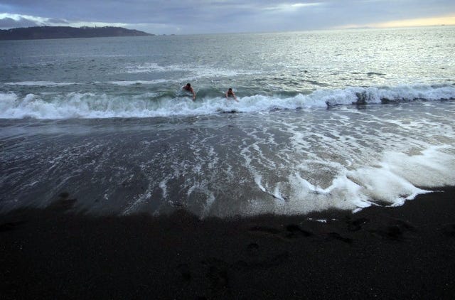
At Black Sands Beach in the Marin Headlands, high energy waves bombard the coastline, made up of mostly basalt, but also conglomerate rock with a mixture of graywacke sandstone, greenstone, limestone, red chert, and gray quartzite, to create a beach of darkly multicolored, rough, large grains of sand. I like this beach because you can feel the strength of the wind and waves, you can see the layered earth tipped sideways from tectonic motion, and you can understand viscerally how these forces shape the rock. You can also nicely exfoliate your feet by walking barefoot on the coarse grains.

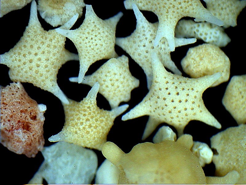
Another contributor to sand are the exoskeletons of dead sea animals. The beaches in Tankah, Mexico, and Elafonisi, Greece, are almost entirely composed of worn down dead animal bits. All sand has some amount of ground up shells, coral, sea urchin spines, sponge spicules, or other skeletal or fossil remains mixed in with the rock.
A recent contributor to sand is human garbage, especially manufactured glass. The amount of sea glass on beaches has decreased in recent years, as people take pieces for their collections and we have shifted to manufacturing more plastic containers.
Finally, a major contributor to sand are rocks that have broken off of the surface of inland mountaintops, fallen into streams, and made the journey to the sea. Rain, wind, and ice erode our land, causing the outermost layers to wash or break off and fall away. This is a slow, relentless process. Jon Erickson puts this into the mass and time scales required when thinking about geology.
“Some 3 billion tons of rock each year are dissolved in water and carried by streams to the sea. This is sufficient to lower the entire land surface of the Earth by as much as an inch in only 2,000 year.”
From “Rock Formations and Unusual Geological Structures,” by Jon Erickson.


In addition, an estimated 25 billion tons of rock fragments are carried by stream runoff into the ocean each year. Once in streams, rock fragments are further worn down by water and collisions with other rocks. Some components of rocks dissolve into the water, while other components break down into such small pieces that they travel in suspension in the river water and settle out on the sea floor once they reach the ocean. Larger rock fragments sink to the bottom of river beds and must make the journey in leaps. They are only pushed forward when the velocity of the river is high enough, such as after a storm.
Only some components of rock are strong enough to make it all the way to the ocean with a grain size larger than 1/16th of a millimeter. Quartz, with its high strength and low chemical reactivity, is the most abundant type of mineral that makes it to the ocean with a large enough grain size to become sand. That is why many of our beaches have a lot of sparkly, light colored quartz sand grains.
Once rocks reach the ocean, the slope of the beach and power of the waves determines what grain size will be deposited along the shore as sand. As a general rule, the sharper the incline, the higher the wave energy, and the larger the grains deposited on the shore.


At Seabright Beach in Santa Cruz, the sand is composed of dirty blonde, soft, smaller grains. I was surprised to learn that human intervention created this beach just 55 years ago. Previously a narrow strip of sand next to the mudstone cliffs, Seabright Beach widened by about 400 feet when the Santa Cruz Yacht Harbor jetty was built in 1963. The San Lorenzo River transports rock sediment from the Santa Cruz mountains to the sea, where waves push some of the grains back toward the coast. Sand grains that had previously been pushed down coast along the shoreline were blocked by the jetty and contributed to Seabright beach instead.

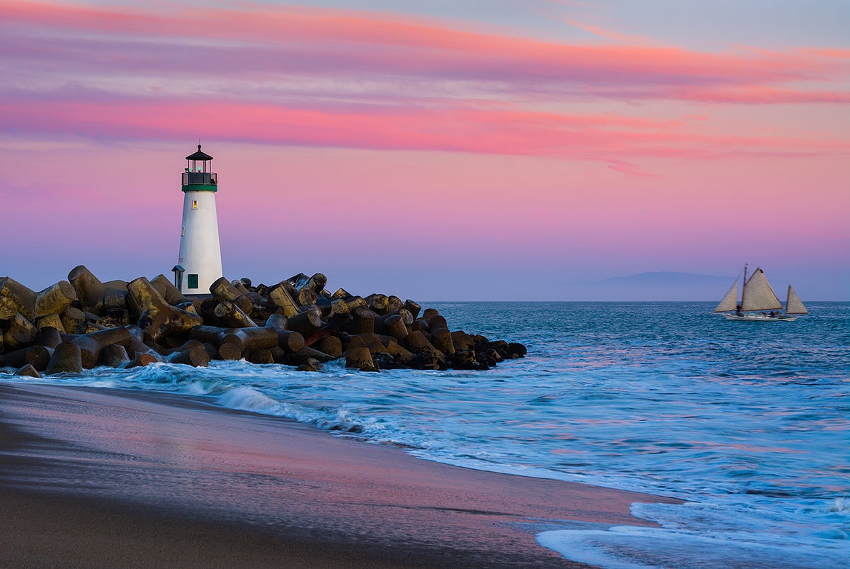
The protected area and gentle slope created by the jetty also selected for lower wave energy and smaller sand grains, making it a pleasant beach to walk on with bare feet, and an inviting ocean to play in.
While attending UC Santa Cruz I regularly came to Seabright Beach to exercise, running back and forth along the length of the beach through shallow waves, then jumping into the ocean to cool off when I was done. I have noticed that my mood shifts to match the energy of the beach I am on. At Black Sands Beach, I feel wild and alert. At Seabright Beach, I feel calm and meditative.
Through the Hourglass and Back Again
The question, “how long does it take to form sand?” is a tough one. What do we consider as the start of this process? Since sand is created from the erosion of rock, perhaps we ask how old the rock at the surface is. For example, the rock forming the coastline at Black Sands Beach first became uplifted above sea level 3-4 million years ago, but dating the fossils of sea animals in the rocks has told us that the rocks were formed a range of 80-200 million years ago. So it took over 80 million years for some of that rock to become sand. Even then, the matter that formed those rocks has been around since our Earth’s origin.


Since the Earth cooled enough for the earliest rocks to solidify from magma over 4 Billion years ago, rocks are forever cycling through different forms. To steal from a major theme of Battlestar Galactica, the sand grains on our beaches are not at the end of their life: these tiny rocks have likely been sand before, and will be sand again. Sand grains get deposited in layers on the ocean floor, and once they are buried deep enough, the pressure transforms sand to sandstone. From there, sandstone may continue to go deeper below Earth’s surface, where the heat and pressure will recrystallize the quartz grains, forming quartzite. If it continues even deeper, the heat will melt the stone, recycling it into the magma. Alternatively, tectonic uplift may push the sandstone or quartzite up to the surface, where exposure to the elements will initiate the process of chemical and mechanical breakdown that will eventually return the rock to the sea.
Geologists look at rocks in order to understand the history of our Earth. The study of geology relies on the principle that slow geological processes and cycles that we currently observe have shaped our planet.
“In the Eastern view of the world, time is a hoop: the ‘ever-circling years’ repeat themselves endlessly. In the Western world, we are accustomed to thinking of time as linear, ‘progressing’ from one point to another. Nothing can repeat itself in this view, because even if all other parts were the same, time would have changed. Such a view makes it difficult for us to comprehend eternity, but it allows us to measure time as if it were units on a ruler.”
From “California Landscape: Origin and Evolution,” by Mary Hill.
Since sand creation is a continuous process that is part of a larger rock cycle, perhaps we only need to consider the rate of erosion when we ask how long it takes to create sand. We could express it as volume of sand created per year from each source. That is also a difficult question to answer, since erosion rates are influenced by topography, weather, and human activities, among other factors, and are therefore highly variable.

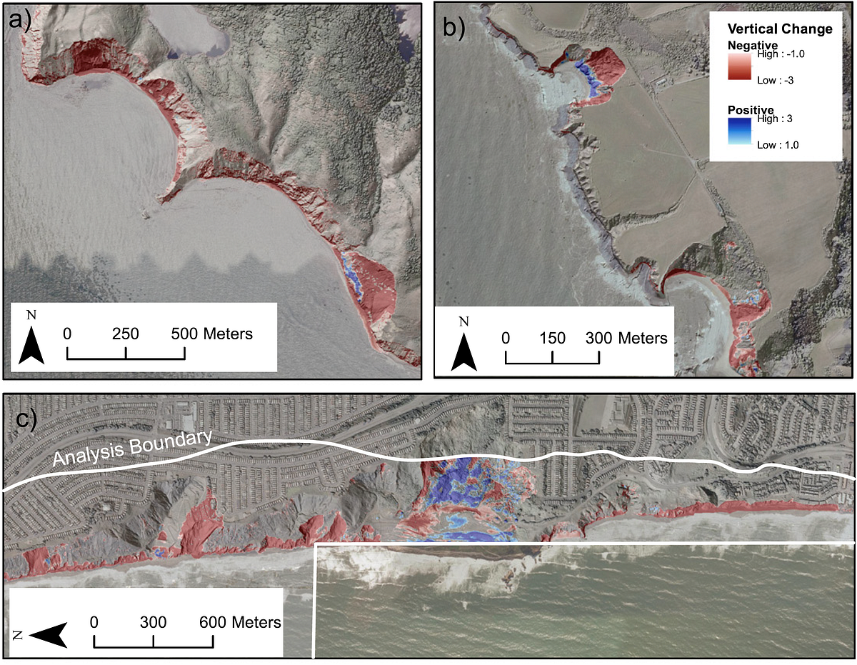
Even the presumably easiest source of sand to measure, cliff erosion, is highly variable and harder to track than you might think. To get a rough idea of erosion rates I looked at a recent study analyzing airborne LiDAR datasets taken along the central and southern California coastline between 1998 and 2010. LiDAR is a technique that uses pulsed laser light to scan the earth below and create a 3D representation that can be measured and studied. LiDAR data of the same coastline at different points in time can be compared to calculate the rate of coastal retreat. The author of the study, Adam P. Young, writes that the mean cliff face and cliff top retreat rates were 0.04 and 0.12 meters per year, respectively, but there are a number of hot spots with high retreat rates of up to 4 meters per year.
This still does not tell you the volume of eroded rock from the coast that eventually became sand, or how long that takes. It does give me the sense that the California coast is slowly but surely falling into the ocean. Perhaps someday my current home in the flat central valley of California will once again be underwater, and the waves will crash into the west facing cliffs of the Sierra Nevada mountain range as they last did 15 million years ago.
Land that falls into the ocean is not lost, it is just on to the next phase of the rock cycle. Jon Erickson writes that “the rise of active mountain chains such as the Himalayas is matched by erosion so that their net growth is almost zero.” There is balance between the creation and destruction of rock. There is something deeply comforting in that.
References
Alden, Andrew. “Geological Outings Around the Bay: Rodeo Beach.” KQED (2012). Link to article.
Elder, William P. “Geology of the Golden Gate Headlands: Field Trip Guidebook.” Link to pdf.
Erickson, Jon. Rock Formations and Unusual Geological Structures: Exploring the Earth’s Surface. New York: Facts On File, Inc., 1993.
Griggs, Gary. Introduction to California’s Beaches and Coast. Berkeley: University of California Press, 2010.
Hapke, Cheryl. “Geology and Coastal Hazards of the Northern Monterey Bay, California: Field Trip Guidebook.” Prepared as part of the California Shore and Beach Preservation Association Conference (2000). Link to pdf.
Hill, Mary. California Landscape: Origin and Evolution. Berkeley: University of California Press, 1984.
Perlman, David. “Ancient sea life thrived in Central Valley.” SF Gate (2009). Link to article.
Young, Adam P. “Decadal-scale coastal cliff retreat in southern and central California.” Geomorphology 300 (2018) 164–175. Link to article.
